


Map
Socialism on Film: Mapped uses our collated location metadata to plot each significant place mentioned in the films on a map of the world. Initially, the map shows a national view, with relevant films represented by grey circles. Zoom in to reveal more specifically plotted cities, regions and natural features – these will be represented by small grey squares.
As well as providing broad geographical groupings of the documents, this feature also allows users to locate individual films by location. For example, if you are interested in Moscow, navigate to Russia, zoom in, click on the square which represents the city and a list of films which touch on Moscow will load in the right-hand pane. A thumbnail, title, production date and genre will automatically load. Click on the arrow to reveal a brief summary and a link back to the video player.
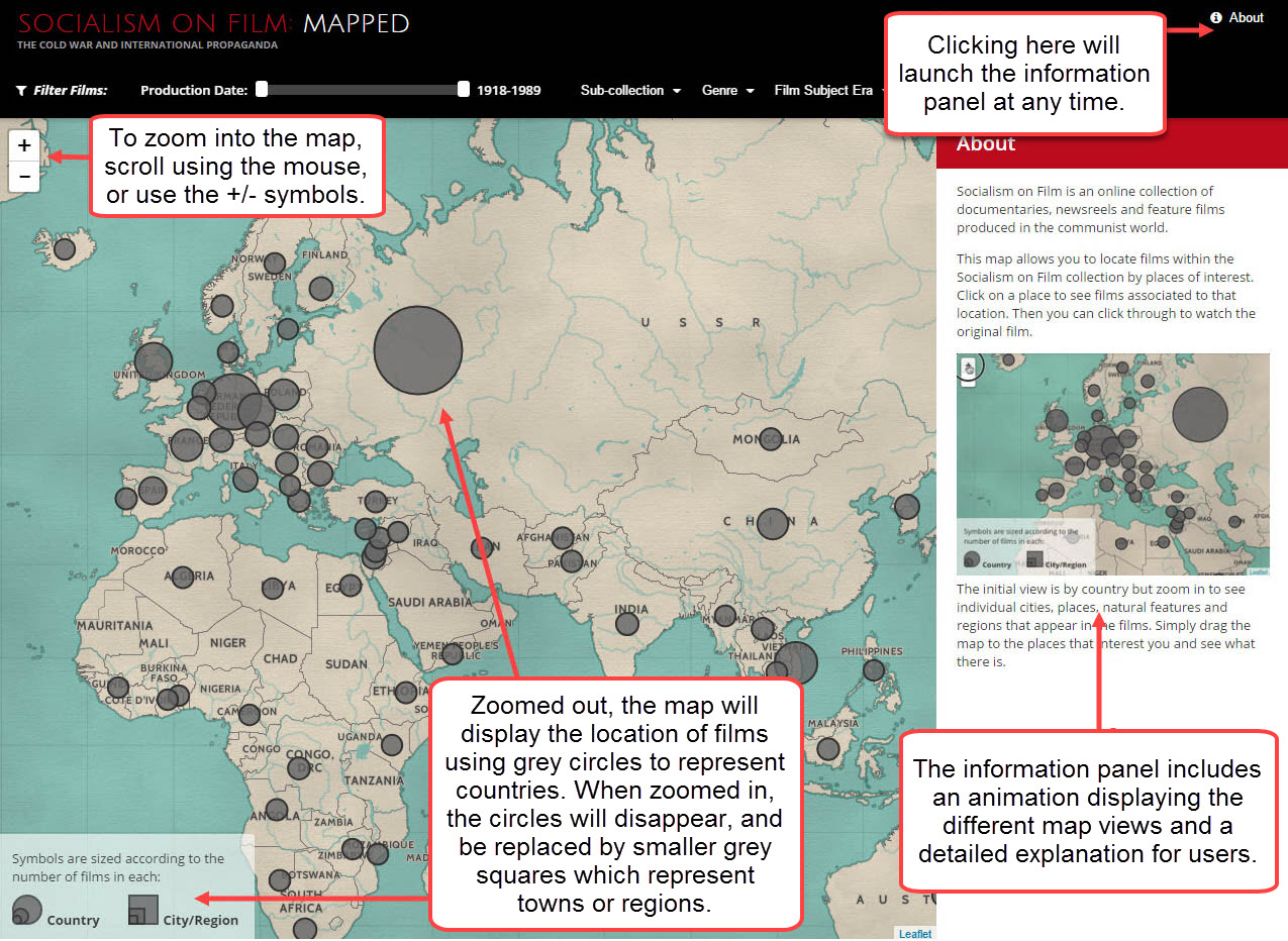 Screenshot of the map and the zoom funtion.
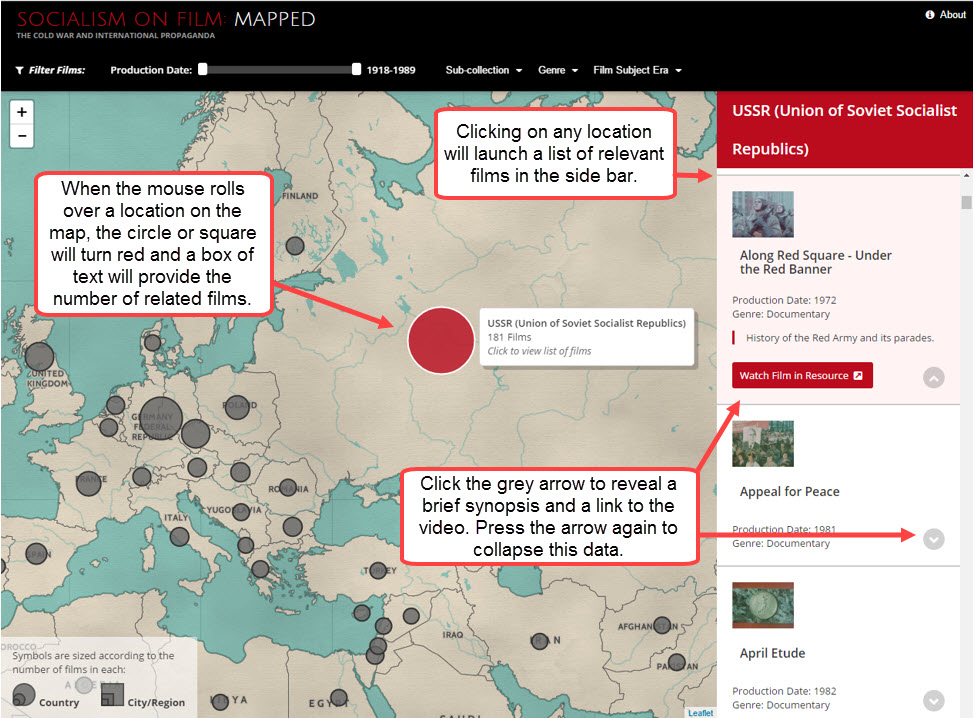
Screenshot demonstrating selection of places and films on the map.
The map view of the films can be filtered by Production date, Sub-collection, Genre and Film subject era to narrow down relevant results.
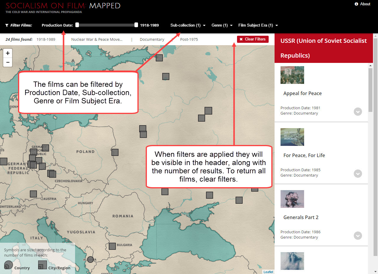
Screenshot showing the use of filters on the map.
Next: Chronology
Previous: Films